15 HA OF LAND - PRODUCTION, WAREHOUSE, SERVICES
łódzkie, wieruszowski, Sokolniki, Bagatelka
14 940 800 zł
100 zł/m2
Investment plot for sell - 149 408.00 sqm
- industrial
- Services
- Other
Legal status
Media
- availability: Possibility of connection
- distance: 5.00 m
- availability: No
- availability: Possibility of connection
- distance: 5.00 m
- availability: Possibility of connection
- type: city
- distance: 400.00 m
- availability: Possibility of connection
- distance: 5.00 m
Access road
Description
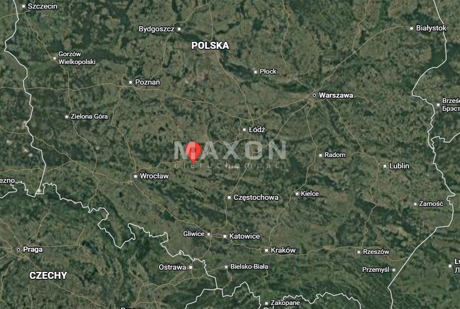
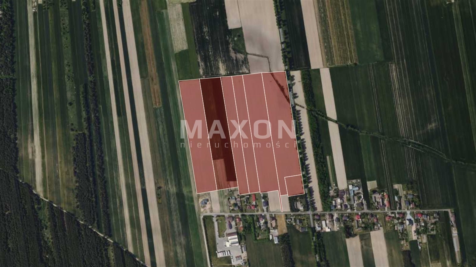
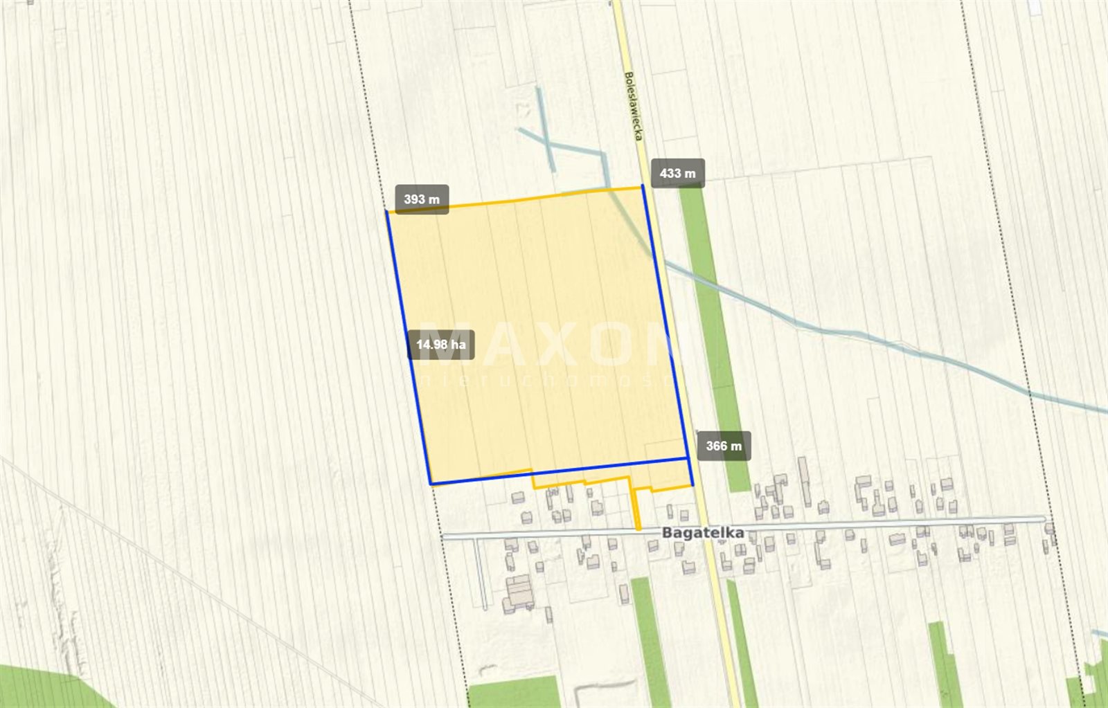
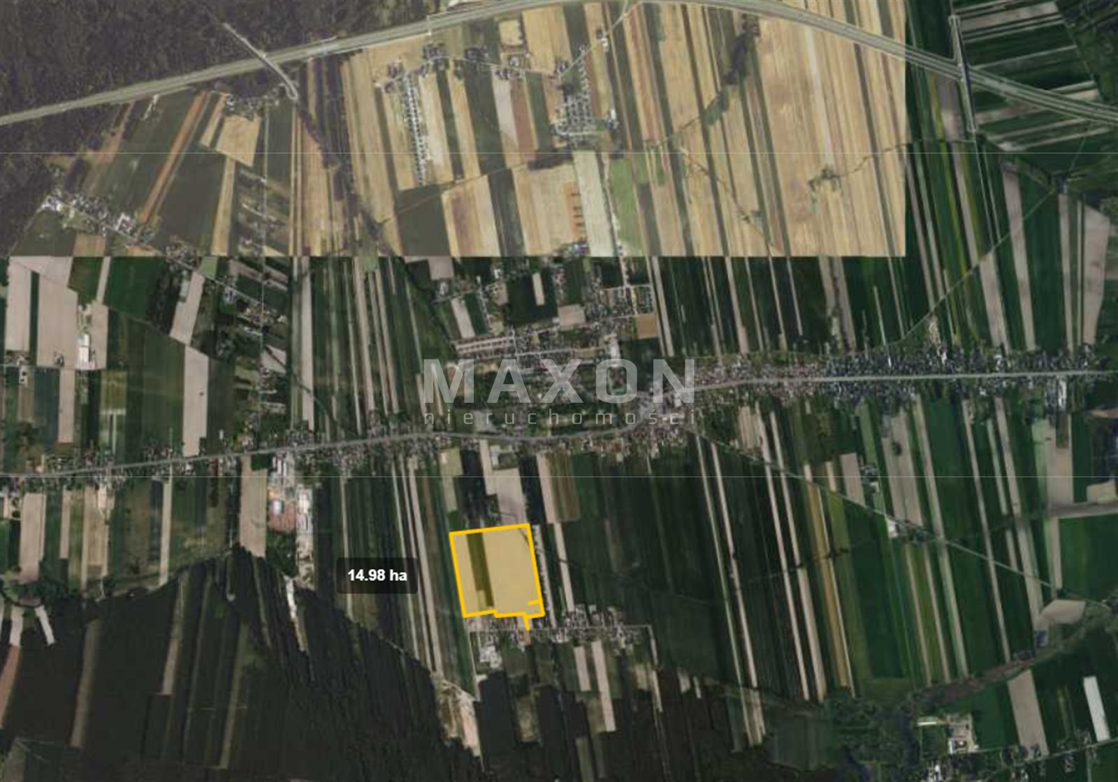
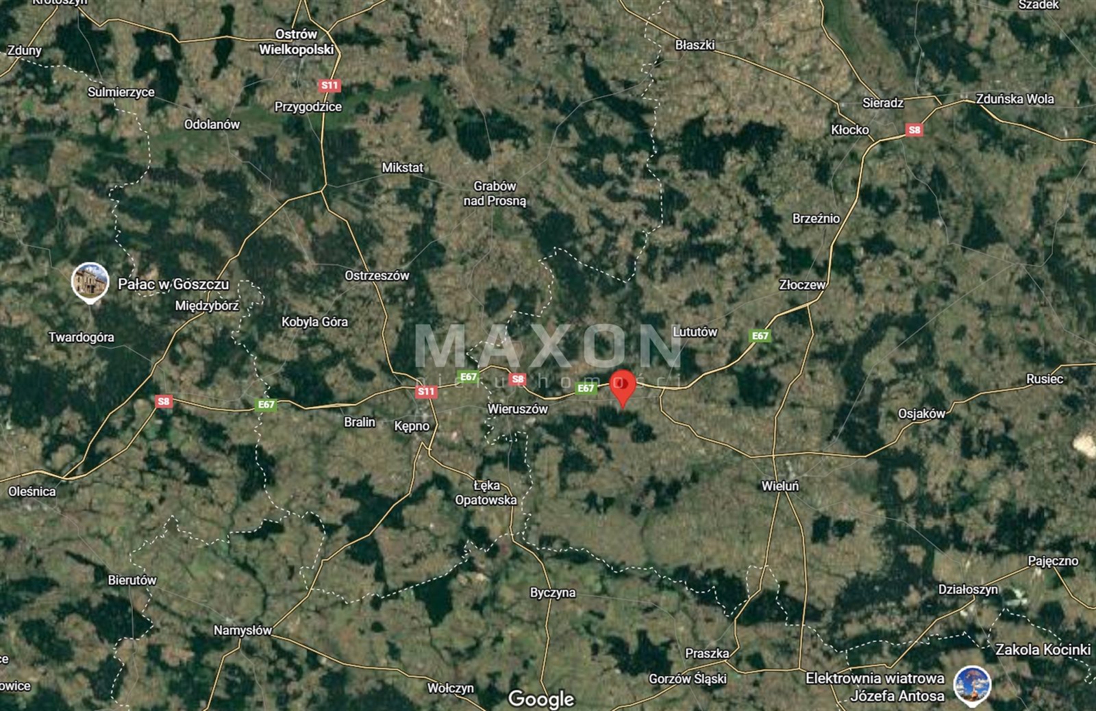
I am pleased to present to you an attractive investment property covering an area of 14.94 ha, located in the village of Bagatelka, in the Wieruszów County, Łódź Province.
The area is covered by a local zoning plan (MPZP), which designates the plots for manufacturing, storage facilities, warehouses, and non-intrusive services.
Thanks to its convenient location and designated use, the property is an excellent opportunity for investors seeking a site for the development of industrial, logistics, or manufacturing operations.
PROPERTY HIGHLIGHTS:
- AREA OF APPROX. 15 HA,
- CLEAR LEGAL STATUS,
- ACCESS TO A PUBLIC ROAD,
- FAVORABLE TERRAIN CONDITIONS—FLAT, NON-FORESTED LOT,
- 15 kV POWER LINE,
- POSSIBILITY OF OBTAINING TWO EXITS FROM THE COUNTY ROAD,
- LOCATED IN A QUIET YET WELL-CONNECTED PART OF THE REGION.
An excellent opportunity for companies seeking land with high investment potential in central Poland.
Basic information about the investment land:
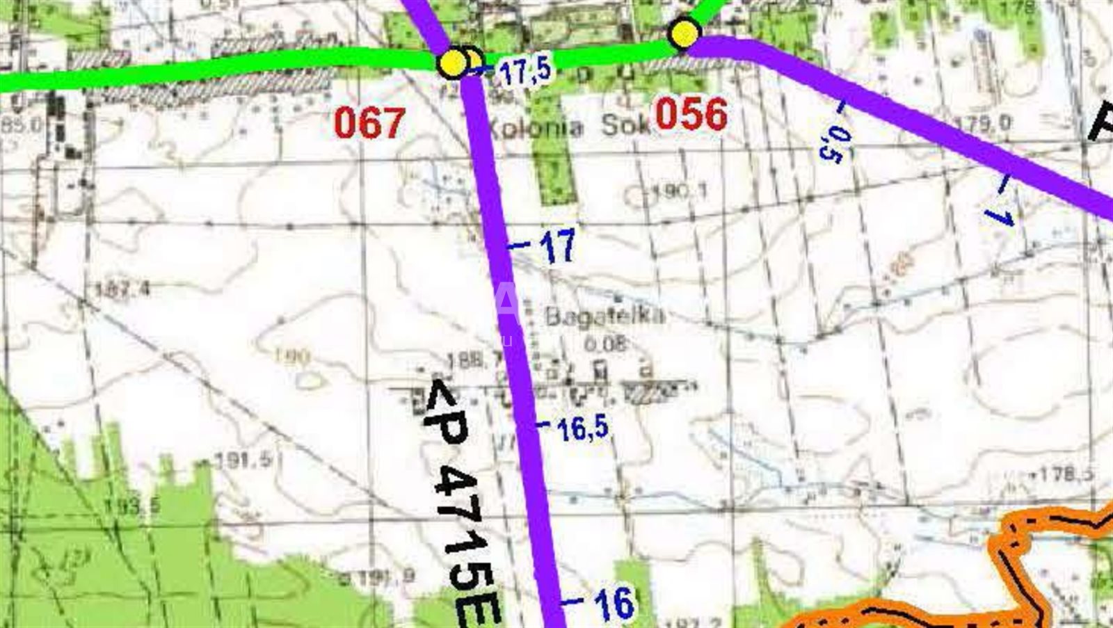
- Location: Łódź Province, Wieruszów County, Sokolniki Municipality, Bagatelka Village,
- Parcel ID (Teryt): 101806_2.0007,
- Soil classes: RIVa, RIVb, RV, RVI, Br/RVI, PsIV, W,
- Utilities: electricity, Internet, water, and sewer—connections available,
- Land and Mortgage Register (KW): exists, encumbered,
- Pending administrative proceedings: none,
- Access: Permission to exit the county road may be obtained,
- Road type: municipal, paved.
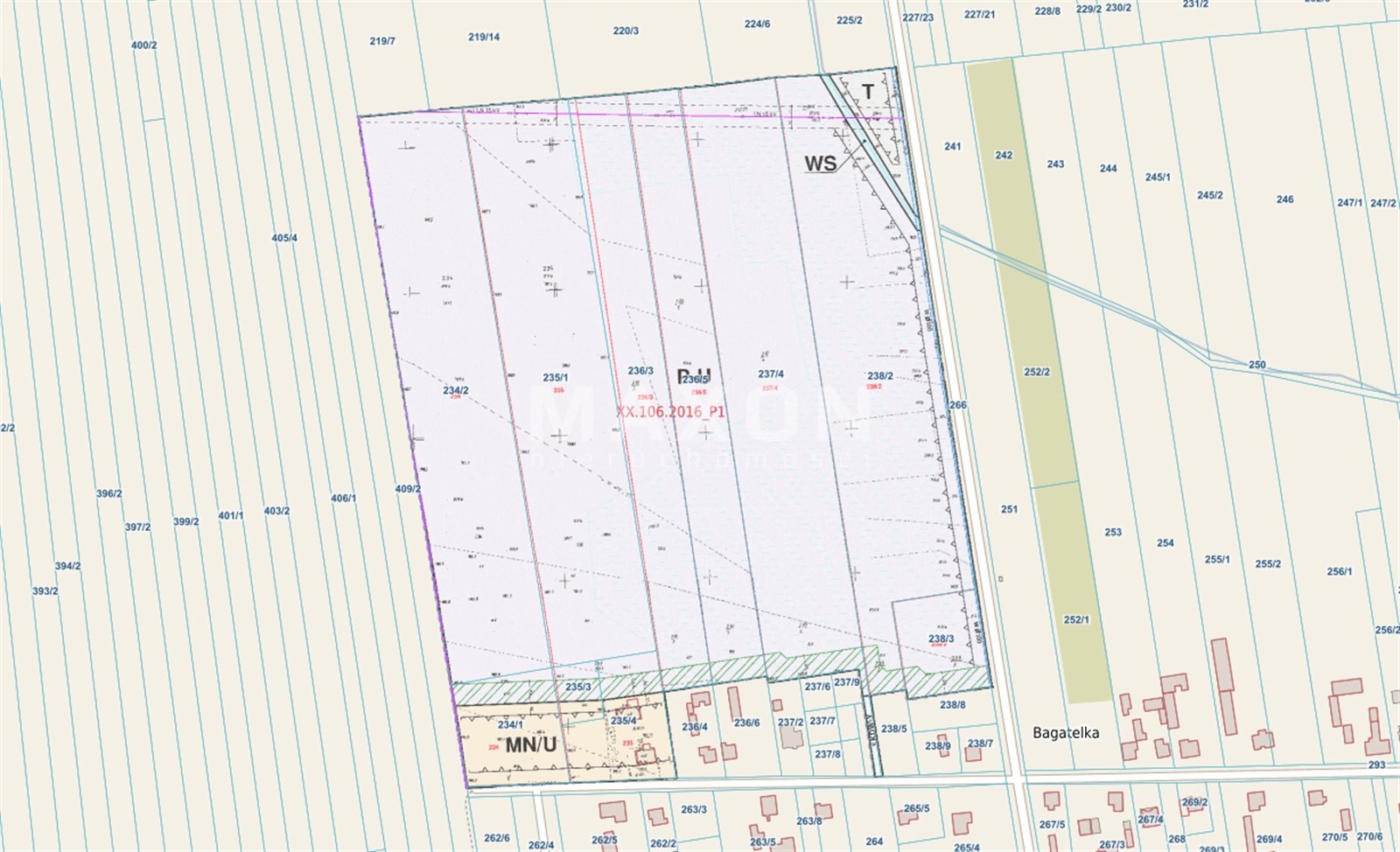
Planning status—Local Spatial Development Plan (MPZP), Resolution No. XX/106/2016 of the SOKOLNIKI MUNICIPAL COUNCIL dated September 29, 2016, on the adoption of a local zoning plan for the area located in the village of Bagatelka (cadastral district of Kolonia Sokolniki).
For the area marked on the plan drawing with the symbol “P-U,” the following is established:
- Primary land use: industrial facilities, warehouses, and services (excluding educational and healthcare services) along with ancillary structures,
- Permitted land use: administrative and social facilities; automotive service facilities (such as gas stations, car washes, and repair shops); facilities generating energy from renewable energy sources with a capacity not exceeding 100 kW, excluding wind turbines; maneuvering areas, storage yards, and parking lots; green spaces; technical infrastructure networks and facilities,
- There is no obligation to consolidate and redistribute real estate in accordance with the procedure specified in separate regulations,
- Minimum lot area: 3,000 square meters,
- Minimum frontage width of the plot: 40.0 m,
- Angle of the plot boundaries (resulting from subdivision) relative to the road right-of-way: 70º–90º,
- Maximum building coverage: 60%,
- Building intensity: minimum – 0.3, maximum – 0.8,
- Minimum proportion of biologically active area: 5%,
- For production facilities, storage facilities, warehouses, service facilities, and ancillary structures, the following apply:
- maximum building height: 30.0 m, excluding ancillary structures and equipment such as masts, chimneys, cranes, silos, etc., for which the maximum height is 40.0 m,
- roof pitch: 0°–20°, - For structures serving as entry points, security facilities, and technical infrastructure equipment, the following apply:
- maximum building height: 5.0 m,
- maximum building footprint: 20.0 m,
- roof pitch: 0°–30°.
For the area marked with the symbol “T” on the plan drawing, the following are established:
- Primary land use: technical infrastructure facilities, including necessary utility networks and access roads,
- Permitted land use: green space.
Road right-of-way width: 13 m; road width: 6 m; weight limit: 20 t.
Location
Don't hesitate to contact us
Zainteresowała Cię nasza oferta lub szukasz podobnej nieruchomości? Zapraszamy do kontaktu!
CZEKANÓW: LAND FOR COMMERCIAL USE AND WAREHOUSES, 3.3 HA
90 zł/sqm
33 021 sqm
161 zł/sqm
17 091 sqm