mazowieckie, otwocki, Kołbiel, Sępochów
330 957 zł
99 zł/m2
Land for sell
Basic
Legal status
Media
Description
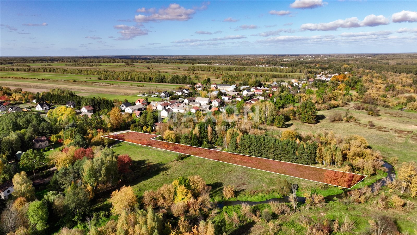
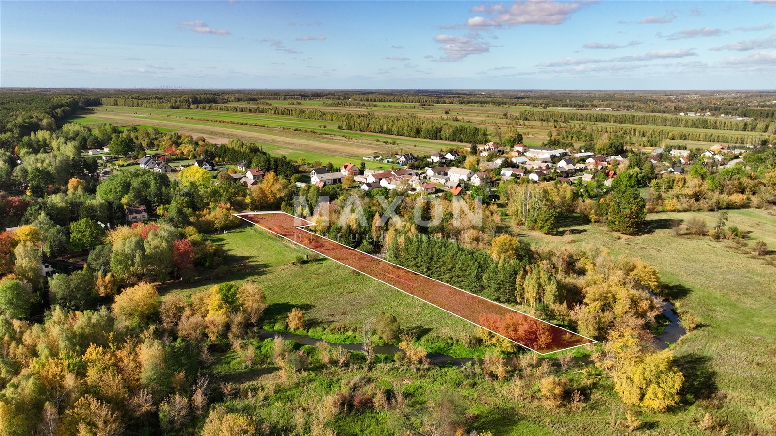
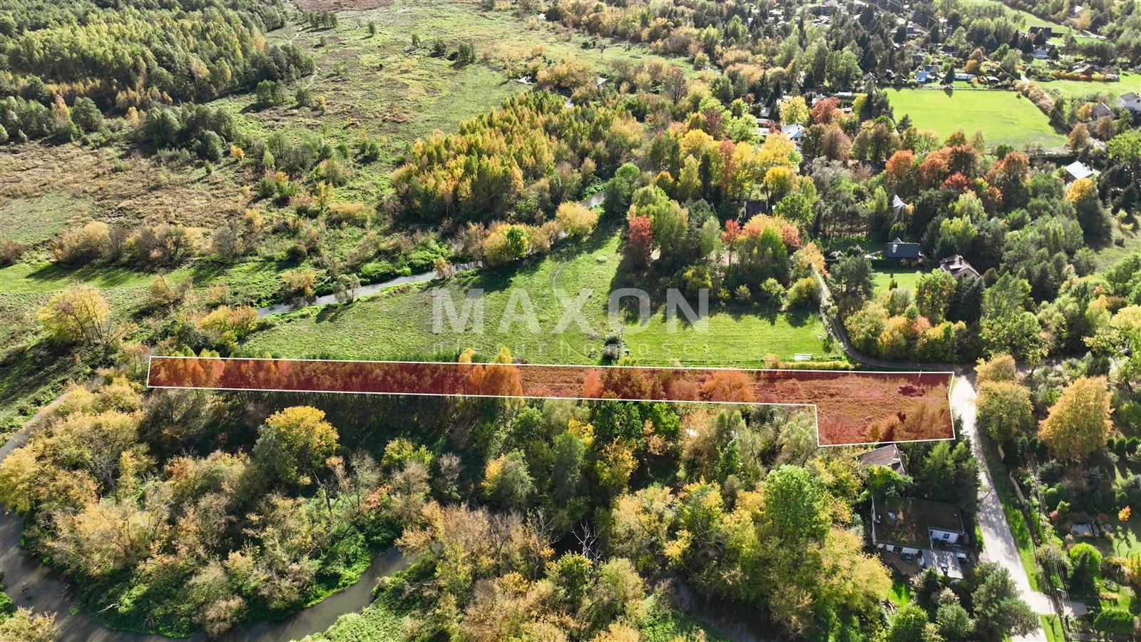
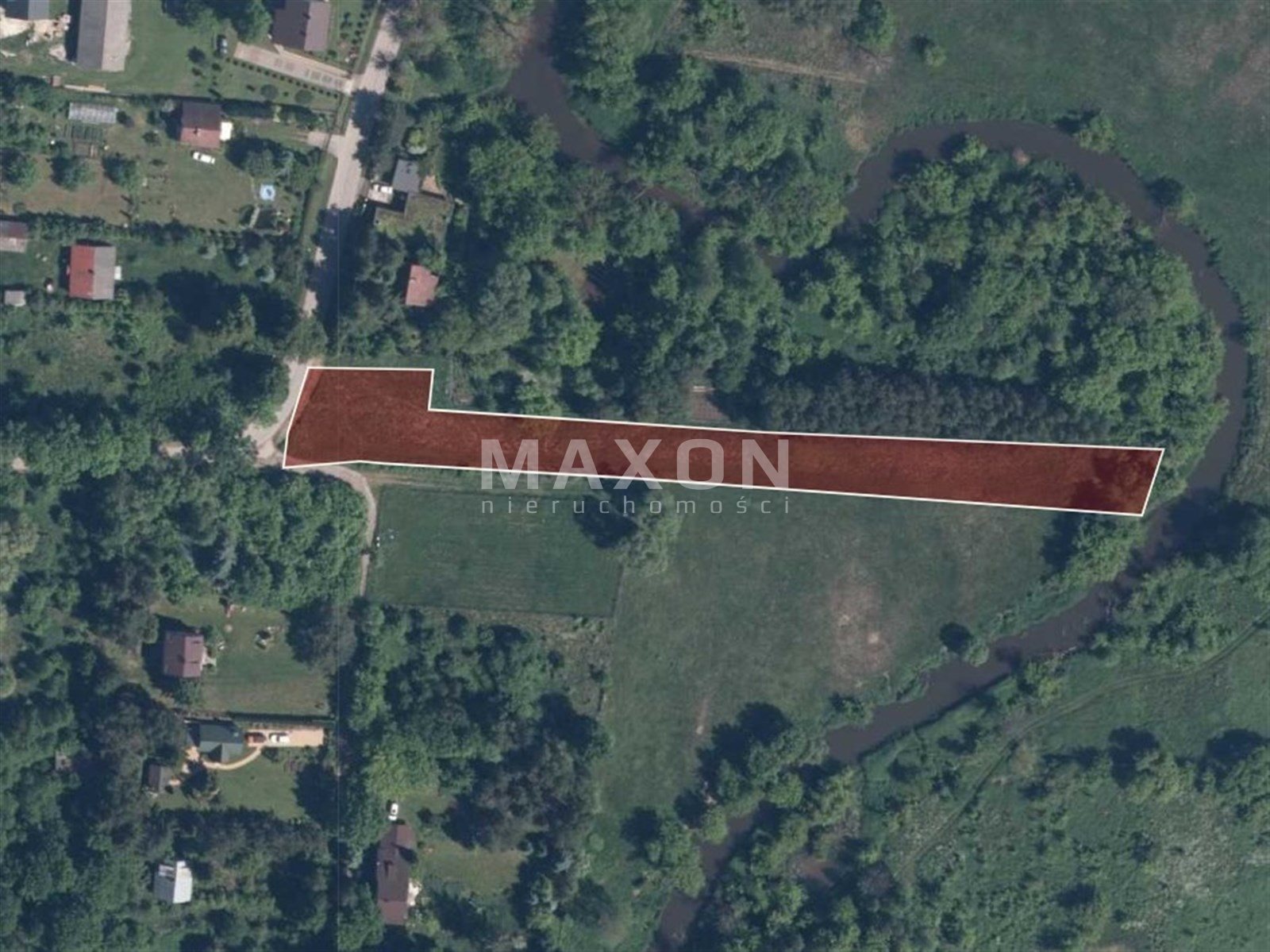
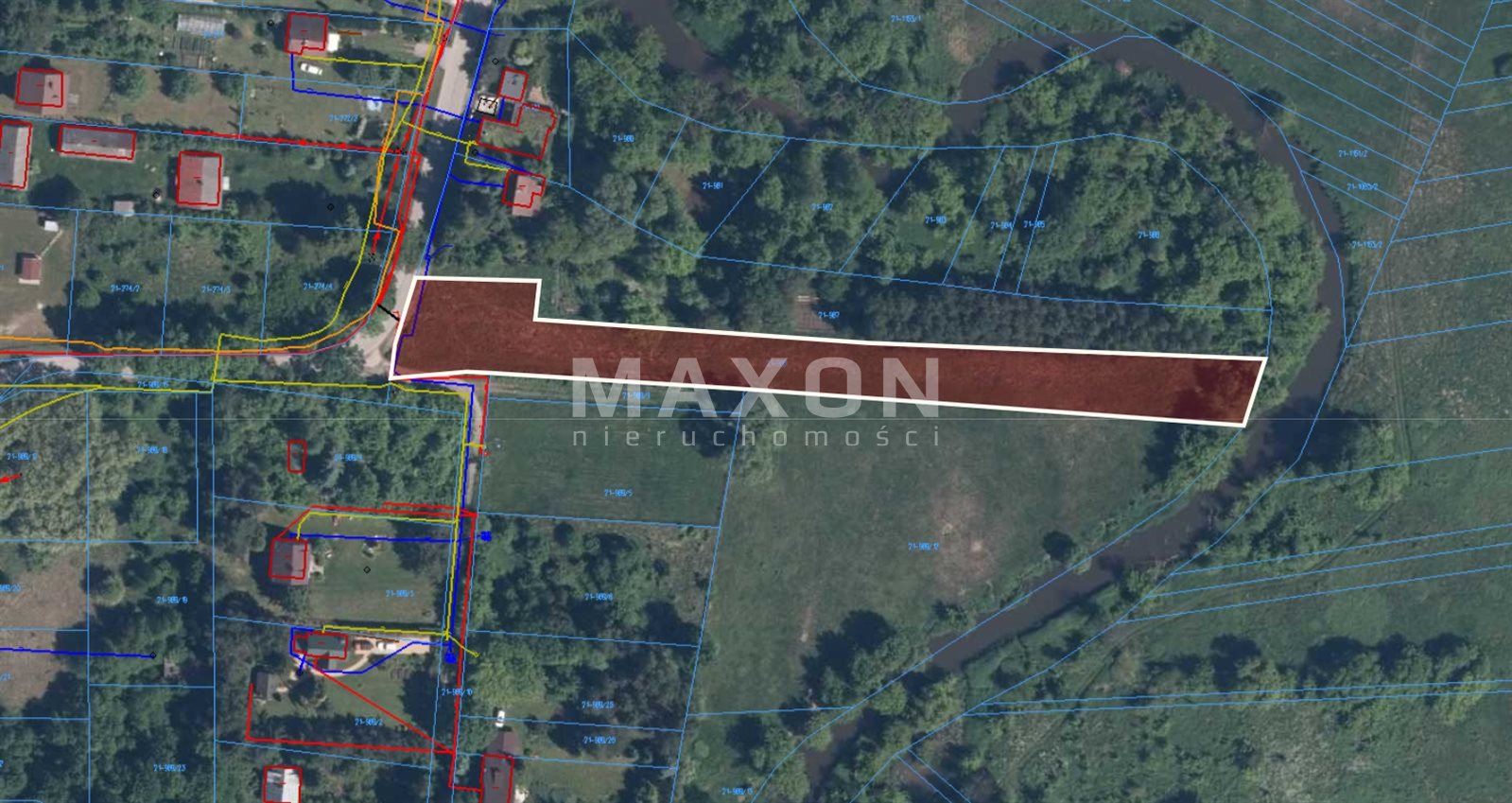
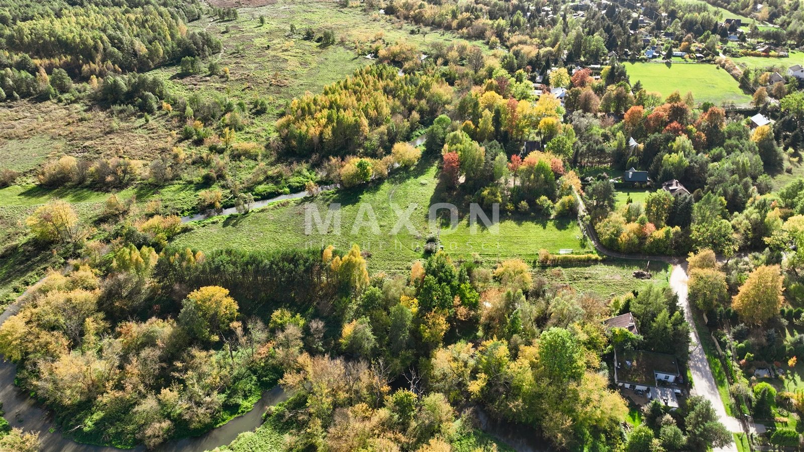
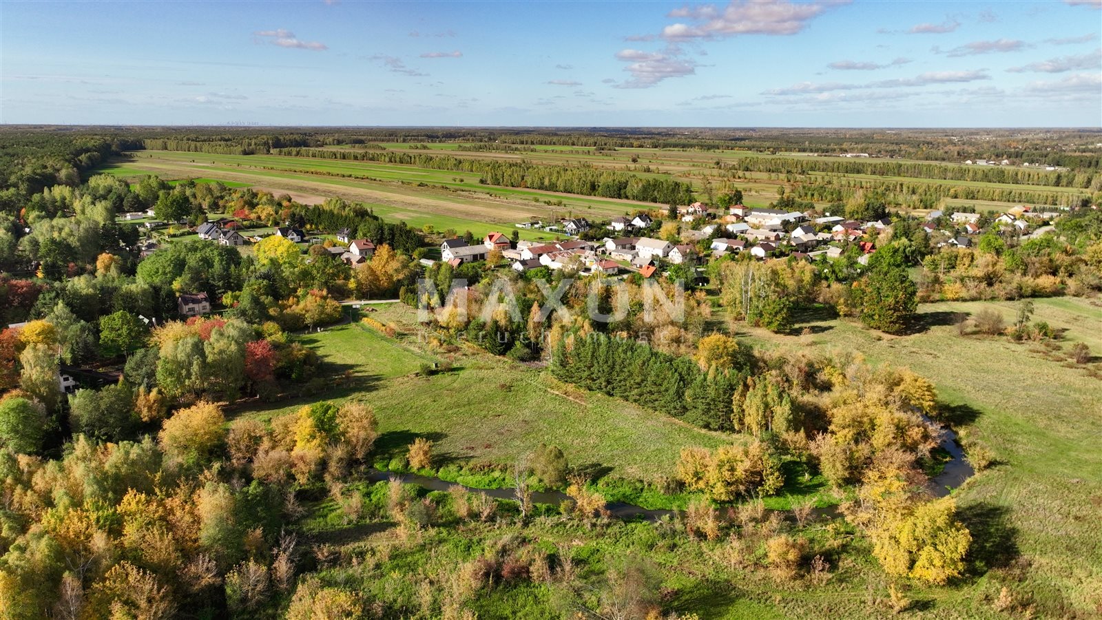
We offer for sale a plot of land on the Swider River in the village of Sępochow, in the municipality of Kolbiel.
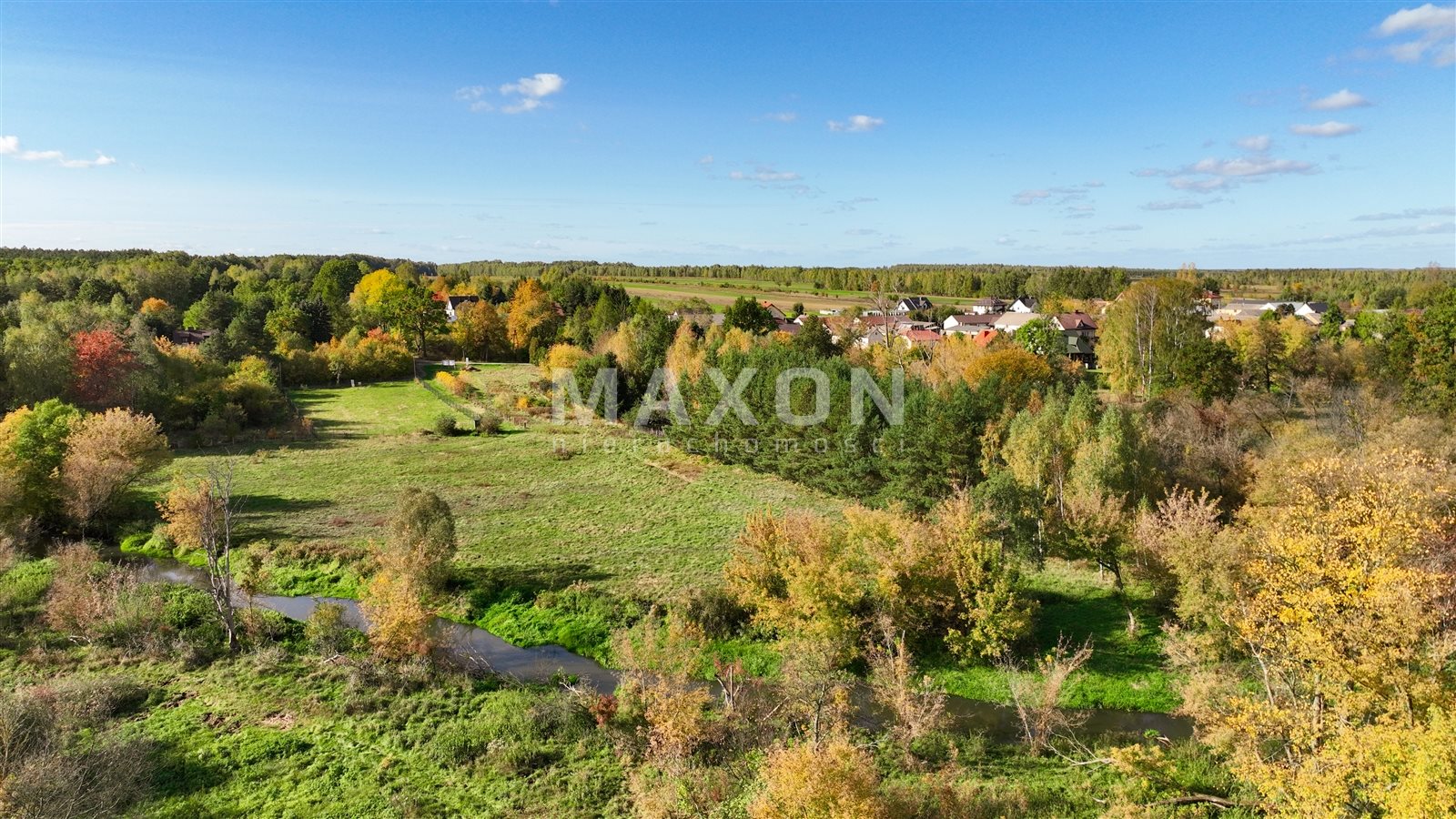
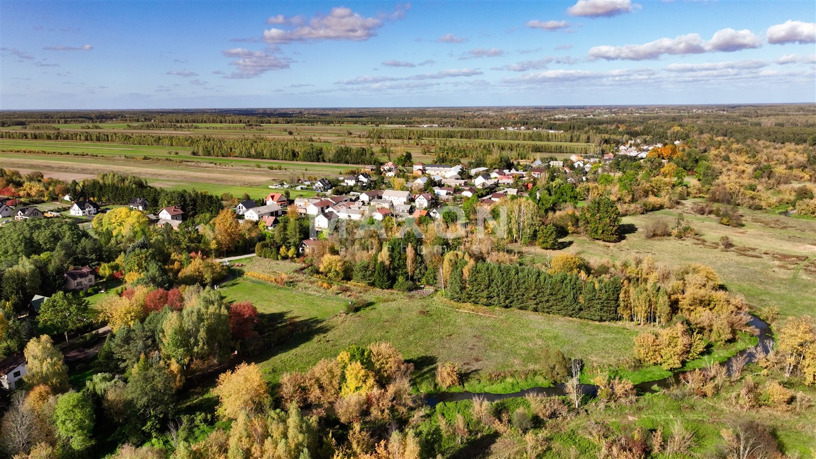
The property is located in a picturesque area, near the buffer zone of the Bocianowskie Bagno Nature Reserve, which guarantees peace, tranquility and proximity to nature.
The property is located in the central part of the village, in the vicinity of single-family buildings and new, aesthetic houses. Surroundings full of greenery, tranquility and natural charm create ideal conditions for residence or development project. Direct access to the Świder River is a unique asset - ideal for lovers of nature and active recreation. The abundance of tourist attractions in the area is conducive to family fun - both in summer and winter.
Great access to Warsaw and quick access to the S17 route make the location as practical as it is picturesque.
Most interesting places in the area:
- The observatory station of the UW Astronomical Observatory,
- The Clove Marsh peat bog,
- The lavender field in Siwianka.
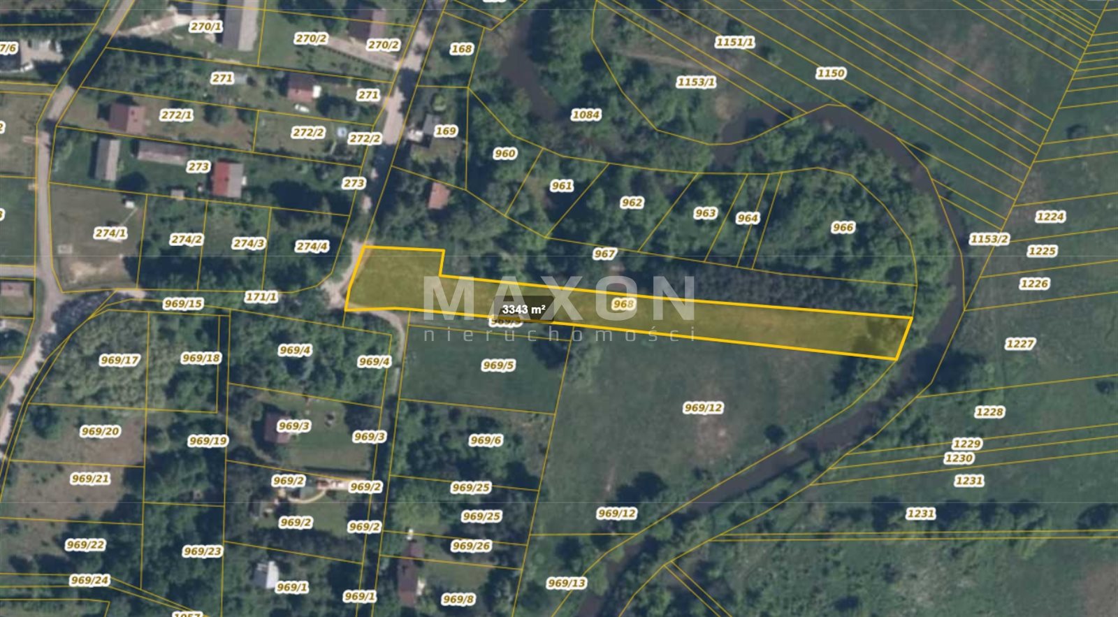
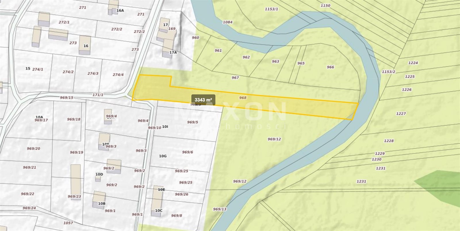
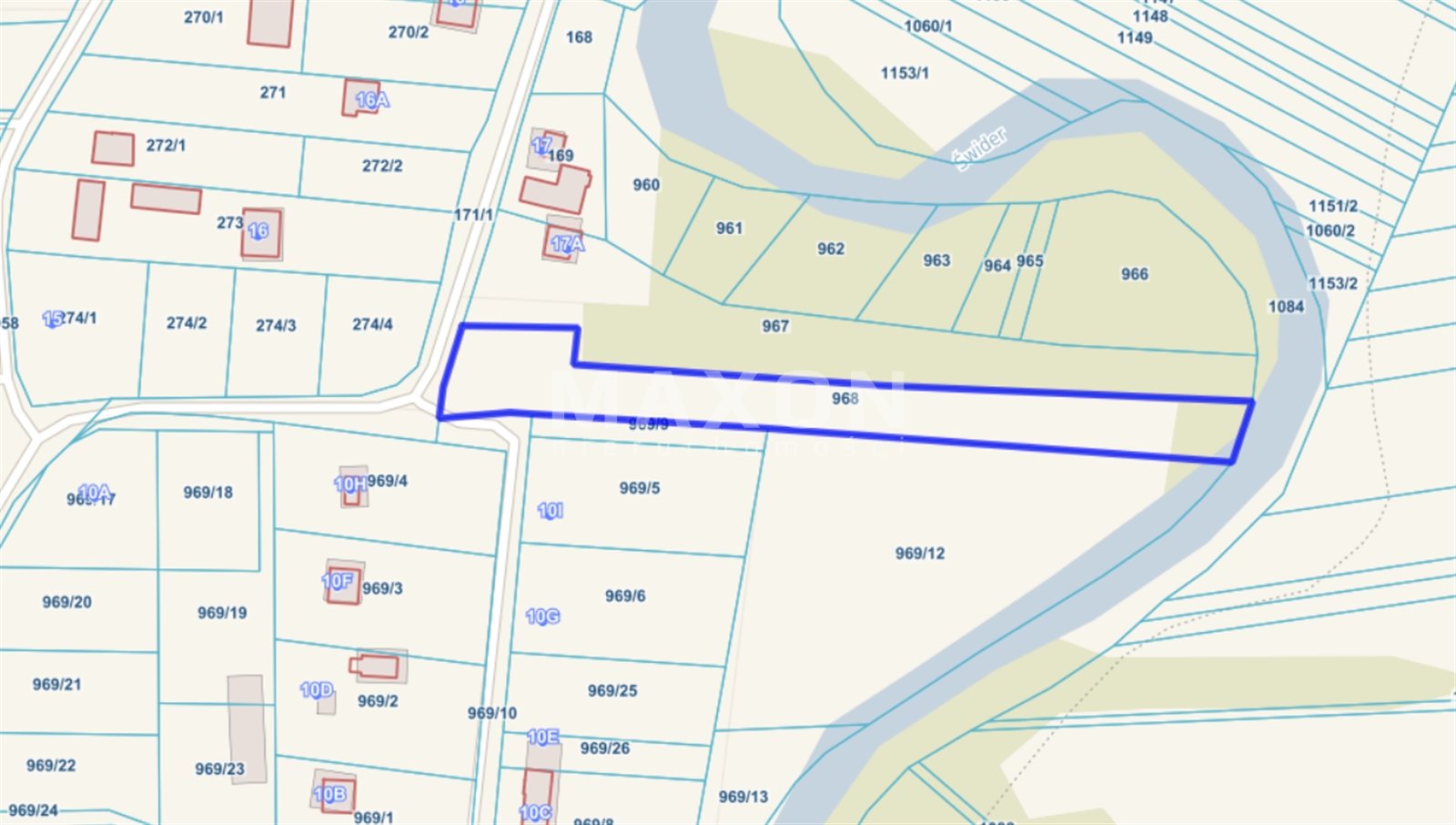
Basic data about the plot:
- Location: Mazowieckie Voivodeship, Otwock County, Kolbiel Municipality, village Sępochów,
- Plot ID (Territory): 141705_2.0021,
- Soil Classes: RIVa, PsIV, Lzr/PsIV,
- Media: water and electricity on the plot, gas on the road, no sewerage,
- KWR: there is, no encumbrance,
- Access: communal road,
- Road Type: asphalt,
- Access to public transport: private bus in Sępochów and train from Stara Wieś.
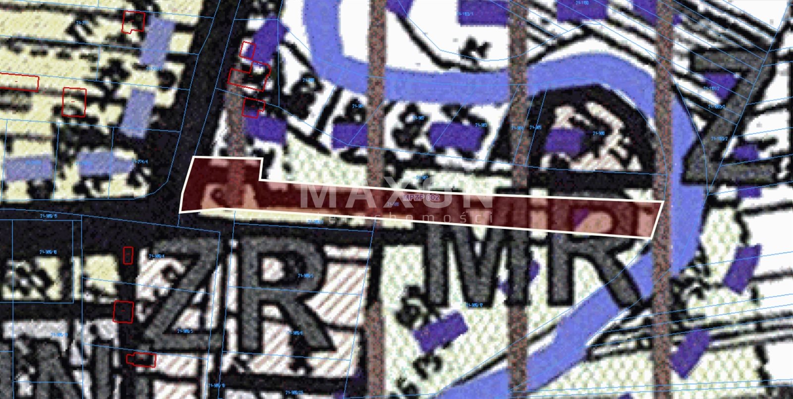
Planning status:
- MPZP Resolution No. XX/142/2005 of the Municipal Council of Kolbiela dated January 25, 2005,
- Designation in the plan "MR",
- Designation of the area: agricultural and homestead development, in which the implementation of services related to agriculture is allowed,
- Height of development up to 2 stories and up to 3 stories in the case of reference to the neighboring development,
- In homestead development, greenery should be provided for min. 60% of the plot area, and in the implementation of economic activities on min. 50% of the plot area, with the exception of areas located within the boundaries of the Nadwiślański Obszar Chronionego Krajobrazu (Nadwiślański Protected Landscape Area) and its buffer zone, where 75% of the biologically active plot area is obligatory.
Location
Movie
Don't hesitate to contact us
Anastasiia Davydenko
Starszy Specjalista ds. Gruntów inwestycyjnych i działek
Call:
Zainteresowała Cię nasza oferta lub szukasz podobnej nieruchomości? Zapraszamy do kontaktu!