Agricultural and development lot, Local Land-Use Plan, S7 Highway
mazowieckie, płoński, Załuski, Kroczewo
120 000 zł
50 zł/m2
Land for sell
Basic
Legal status
Media
Description
☀️ Agricultural and construction land, plot covered by the Local Zoning Plan (MPZP), with an agricultural section (R) and a section designated for farm buildings and single-family residential development (75 RM, MN). Utilities—connections available: water, electricity, gas, and telecommunications. Access to the S7 highway☀️
Agricultural and residential plot for sale with an area of approx. 2,400 sq m.
Pursuant to the Resolution of the Płońsk Municipal Council dated March 25, 2024, the Council is proceeding with the preparation of the general plan for the municipality of Płońsk. The general plan covers the area within the administrative boundaries of the Płońsk Municipality, excluding restricted areas other than those designated by the minister responsible for transportation.
The lot is ideal for commuters traveling to the northern part of Warsaw and for employees of logistics centers located a short drive east of the lot.
Strategic location:
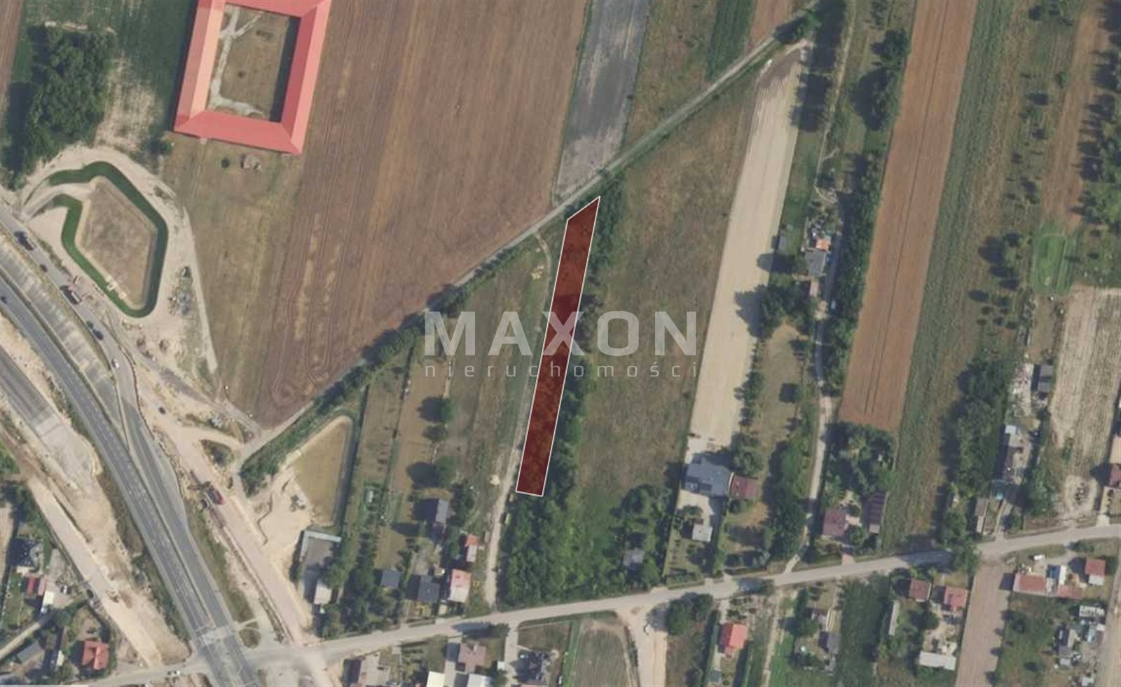
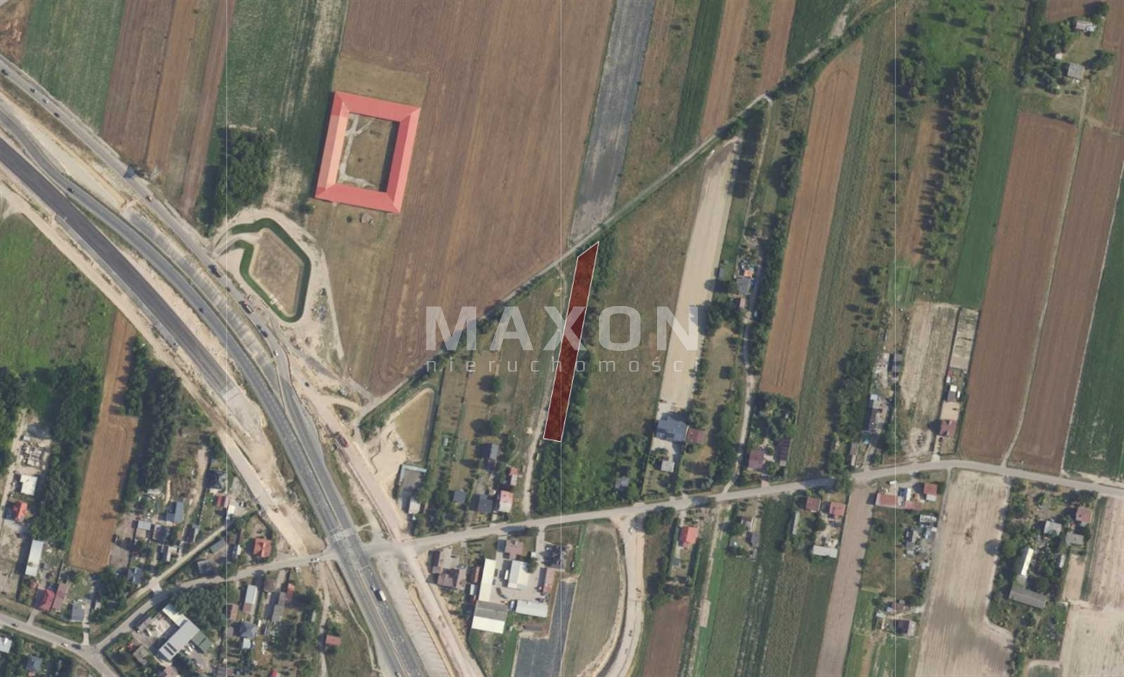
- 700 meters from the new “Kroczewo” overpass on the S7 expressway (nearest exit—Załuski),
- 9 km by car from Warsaw Modlin Airport,
- Right next to the entrance route to Warsaw (Łomianki) and the exit route to the Tri-City.
Utilities:
- Electricity: in progress.
- Water supply: runs through the lot; connection can be made.
- Gas: in progress.
- Telecommunications: in progress.
- Sewage—no sanitary sewer system. Until the sanitary sewer system is completed: private septic tank.
Plot details:
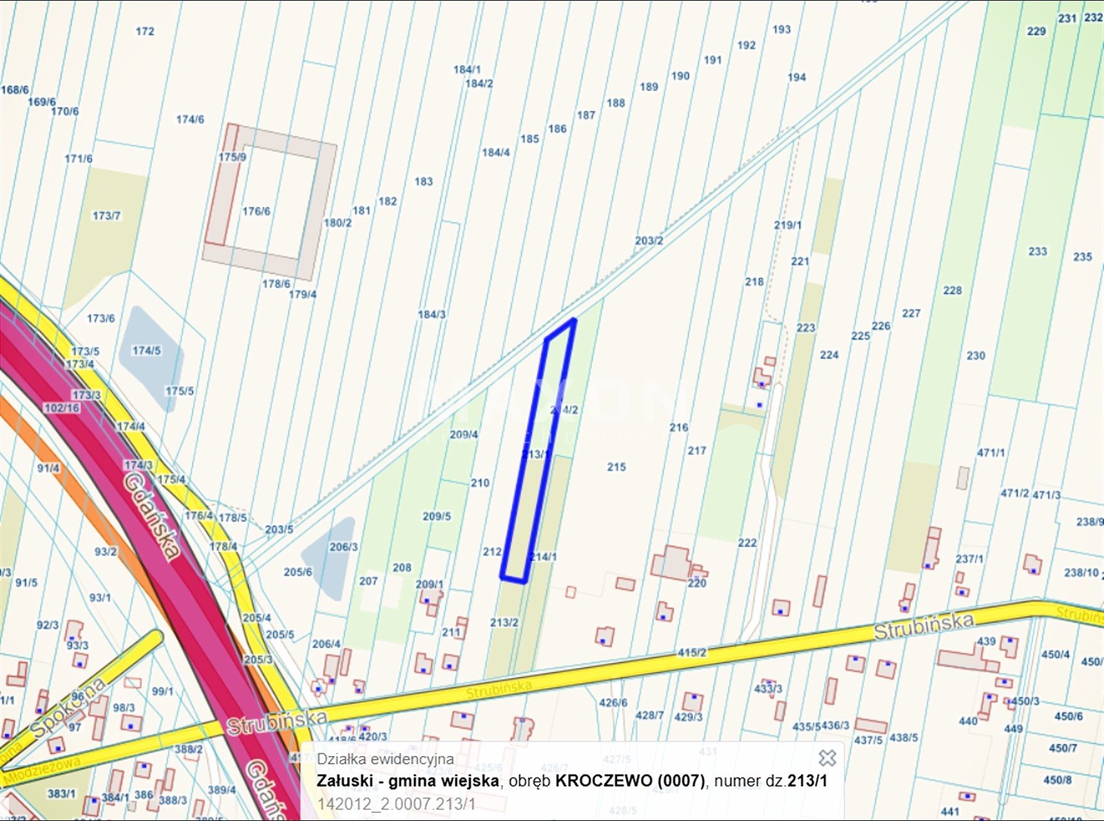
- Location: Mazowieckie Province, Płońsk County, Załuski Municipality, Kroczewo,
- Identifier (Teryt): 142012_2.0007,
- Soil classes: RIIIa and RIIIb,
- Legal status: Full ownership,
- Land Register: Yes,
- Access: municipal road,
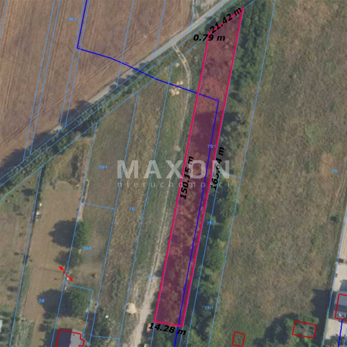
- Geometric plot PL-1992: 0.2299 ha,
- Area in the land registry: 0.24 ha,
- Perimeter: 351 m,
- Plot dimensions: approx. 21.42 x 165.64 x 14.28 x 150.15 meters,
- The terrain is flat; the plot is rectangular,
- Access to the plot is possible from Spokojna Street.
Development possibilities:
- Single-family residential and farm buildings,
- Commercial development is permitted provided that any nuisance does not extend beyond the plot boundaries,
- Biologically active area: at least 70% of the plot’s area,
- Building area: max. 30% of the plot area (applies to the portion of the plot designated as MPZP 75 RM, MN),
- Building height: up to 2 above-ground stories (including a usable attic),
- Building height: residential buildings up to 9 meters; outbuildings—single-story,
- Roofs: gable or hipped, with a slope angle of 30° to 45°,
- Construction of structures harmful to the environment is prohibited,
- No multi-family housing allowed.
Larger towns:
- Warsaw/Łomianki (31 km),
- Nowy Dwór Mazowiecki (12 km),
- Płońsk (23 km).
The area is covered by Resolution No. LXXV/523/2024 of the Załuski Commune Council dated March 25, 2024, regarding the commencement of the preparation of the general plan for the Płońsk commune.
The area is covered by Resolution No. 47/X/2007 of the Załuski Commune Council dated October 10, 2007, on the Local Spatial Development Plan.
Location
Don't hesitate to contact us
Zainteresowała Cię nasza oferta lub szukasz podobnej nieruchomości? Zapraszamy do kontaktu!